By Betsy Levinson — Betsy@concordbridge.org
Before the ground freezes, a colorful wayfinding mural will be installed on Main Street in the Milldam.
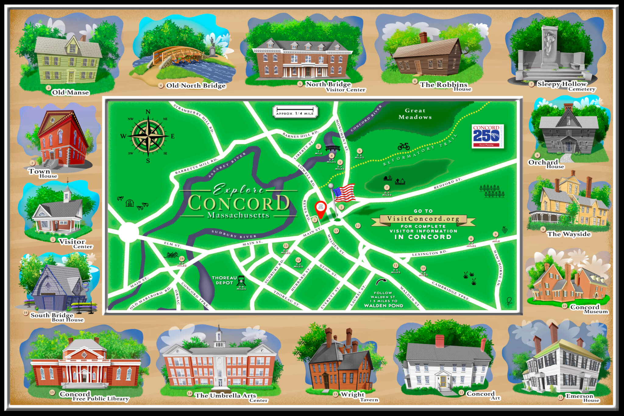
It’s intended not as a street map, but as an artistic display of favorite historical sites oriented around Concord Center, says Di Clymer, chair of the Art, Literary, and Music subcommittee of the Concord250 Executive Committee.
Artist Steve Bermundo designed the 6’ x 4’ illustrated display as a digital print that will be mounted on a thin sheet of aluminum.
‘Whimsical, yet respectful’
“I understood that whatever direction I took with the design of the map, it needed to retain the aesthetic of Concord and its revered history,” Bermundo says.
“I wanted visitors who viewed the map to be intrigued and compelled to see each site in person while giving residents and locals a sense of pride in seeing their town represented in a fun and whimsical, yet respectful, way.”
“It’s a playful design,” says Mimi Graney, town economic vitality manager.
Bill Crosby of Crosby Design will install the work on mahogany posts on the small strip of town-owned land adjacent to the Visitors Center on Main Street. Crosby says he will “refresh the stain annually as needed.”
A group effort
The Historic District Commission, the nearby Bank of America and Middlesex Savings Bank, Concord Public Works Department, Select Board, and other boards and committees signed off on the project.
The project cost $2,225, Graney says, “with funding pledged by the Concord250 Executive Committee,” as she noted in a memo to the Select Board.
Clymer says the traditional town map inside the Visitors Center is small and “hard to read.”
“It became apparent it would be useful to have an outdoor display,” she says. “It’s educational and creative, not just a map. It will bring a smile to those who look at it.”


